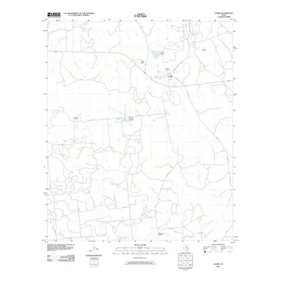
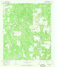
2010 Map of Caddo
USGS Topo · Published 2010About this map
Caddo remains the primary settlement in this corner of Stephens County, situated along State Loop 252 and FM 717. The landscape is defined by its industrial and agricultural history, visible through the Gourley Oil Field to the northeast and water management infrastructure like T P Lake and the Ohio Oil Company Reservoir. Numerous family and community landmarks provide rich detail for genealogists, including Caddo Cemetery, Swenson Cemetery, and Macedonia Cemetery. The terrain is marked by drainage systems such as Caddo Creek and Little Cedar Creek, which converge near Yates Hill. Significant engineering features, such as Rogers Dam and the Ohio Oil Company Lake Dam, highlight the region's historical reliance on managed water resources for local industry and ranching.
Find a feature on this map
32 named features on this map. Tap any name to fly to it.
Don’t see what you’re looking for? This feature index may not catch every label — zoom into the map to look around manually.
Map Details
Editions of this 2010 Caddo Map
This is the sole edition of this map. No revisions or reprints were ever made.
Other maps of this area

1890 · Breckenridge
USGS Topo · 1:125,000

1924 · Breckenridge 1-d
USGS Topo · 1:48,000

1931 · Ivan
USGS Topo · 1:62,500

1954 · Abilene
USGS Topo · 1:250,000

1958 · Abilene
USGS Topo · 1:250,000
1967 · Wayland
USGS Topo · 1:24,000

1967 · Necessity
USGS Topo · 1:24,000
1967 · Grand Lake
USGS Topo · 1:24,000
1967 · Brad
USGS Topo · 1:24,000
1967 · Ivan South
USGS Topo · 1:24,000