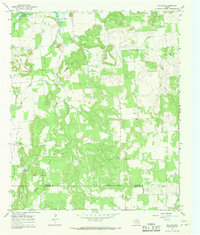
1967 Map of Wayland
USGS Topo · Published 1970About this map
Wayland and the surrounding ranchlands of southern Stephens County are defined by a complex drainage system feeding into Lake Daniel. The landscape is dominated by distinctive topographic features such as Bald Mountain, Maxwell Mountain, and Steal Easy Mtn, which overlook a network of watercourses including Gonzales Creek and Gunsight Creek. An Old Railroad Grade traces a path through the center of the sheet, providing evidence of earlier transportation corridors that once linked these isolated settlements.
Find a feature on this map
22 named features on this map. Tap any name to fly to it.
Don’t see what you’re looking for? This feature index may not catch every label — zoom into the map to look around manually.
Map Details
Editions of this 1967 Wayland Map
2 editions found
Other maps of this area

1890 · Breckenridge
USGS Topo · 1:125,000

1894 · Eastland
USGS Topo · 1:125,000

1954 · Abilene
USGS Topo · 1:250,000

1958 · Abilene
USGS Topo · 1:250,000

1961 · Buck Mountain
USGS Topo · 1:24,000

1966 · Cisco North
USGS Topo · 1:24,000

1966 · Eastland
USGS Topo · 1:24,000

1966 · Ranger
USGS Topo · 1:24,000

1967 · Necessity
USGS Topo · 1:24,000
1967 · Harpersville
USGS Topo · 1:24,000