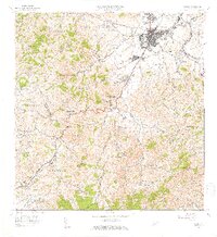
1957 Map of Caguas
USGS Topo · Published 1959About this map
Caguas sits at the heart of this mid-century landscape, positioned near the confluence of the Río Grande de Loíza and Río Turabo. The map captures a moment of established rural life transitioning around the urban center, where the Centra Santa Juana industrial facility and the Antena de Radio (WVJP) reflect the era's local infrastructure. Beyond the town, the terrain rises into the surrounding hills, marked by prominent peaks such as Cerro Las Piñas and Cerro Gregorio.
Find a feature on this map
59 named features on this map. Tap any name to fly to it.
Don’t see what you’re looking for? This feature index may not catch every label — zoom into the map to look around manually.
Map Details
Editions of this 1957 Caguas Map
2 editions found
Other maps of this area

1946 · Patillas
USGS Topo · 1:30,000

1946 · Aguas Buenas
USGS Topo · 1:30,000

1946 · Cayey
USGS Topo · 1:30,000

1946 · Comerio
USGS Topo · 1:30,000

1946 · Naranjito
USGS Topo · 1:30,000

1946 · Gurabo
USGS Topo · 1:30,000

1946 · Juncos
USGS Topo · 1:30,000

1946 · Yabucoa
USGS Topo · 1:30,000

1946 · Caguas
USGS Topo · 1:30,000
1947 · Caguas NE
USGS Topo · 1:10,000
Featured Places
- Caguas
- Sector Héctor Rivera, Caguas
- Comunidad Hacienda Ramonita, Caguas
- Sector Cano Rivera, Caguas
- Sector Capilla Sagrada Familia, Caguas