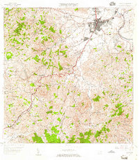
1957 Map of Caguas
USGS Topo · Published 1959About this map
Caguas serves as the focal point of this mid-century landscape, positioned at a vital crossroads where the Rio Grande de Loiza meets major regional routes. The map illustrates a transitional period for the area, balancing industrial processing at the Central Santa Juana and the Planta de Purificación with the traditional agricultural character of the surrounding barrios. In the upland areas to the south and west, the terrain is marked by high points like Cerro Las Piñas and Cerro Gregorio, while smaller settlements such as Sumidero, Cañaboncito, and Turabo appear connected by a growing network of insular routes.
Find a feature on this map
68 named features on this map. Tap any name to fly to it.
Don’t see what you’re looking for? This feature index may not catch every label — zoom into the map to look around manually.
Map Details
Editions of this 1957 Caguas Map
2 editions found
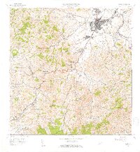
Other maps of this area

1946 · Patillas
USGS Topo · 1:30,000

1946 · Aguas Buenas
USGS Topo · 1:30,000

1946 · Cayey
USGS Topo · 1:30,000

1946 · Comerio
USGS Topo · 1:30,000

1946 · Naranjito
USGS Topo · 1:30,000

1946 · Gurabo
USGS Topo · 1:30,000

1946 · Juncos
USGS Topo · 1:30,000

1946 · Yabucoa
USGS Topo · 1:30,000

1946 · Caguas
USGS Topo · 1:30,000
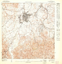
1947 · Caguas NE
USGS Topo · 1:10,000
Featured Places
- Caguas
- Sector Doña Munda, Caguas
- Sector Almena, Aguas Buenas
- Sector Turabo Abajo, Caguas
- Sector Benito Guzmán, Caguas