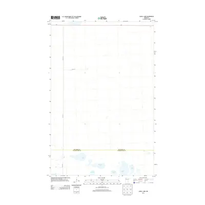
2013 Map of Cahill Lake
USGS Topo · Published 2013About this map
The boundary between Beltrami Co and Clearwater Co runs through this northern Minnesota landscape, where a dense cluster of glacial lakes dominates the southern terrain. This 2013 survey illustrates the remote character of the region, featuring Cahill Lake, Miskogineu Lake, and Roosevelt Lake among others. The presence of Res Hwy 22 and Res Hwy 23 indicates the specialized road network serving the area. This map is particularly useful for identifying the specific hydrography of the region, as many smaller unnamed ponds and marshes surround the primary named water bodies. The alignment of Mn-1 across the northern edge provides the primary east-west corridor through this sparsely settled wetland and forest environment.
Find a feature on this map
11 named features on this map. Tap any name to fly to it.
Don’t see what you’re looking for? This feature index may not catch every label — zoom into the map to look around manually.
Map Details
Editions of this 2013 Cahill Lake Map
This is the sole edition of this map. No revisions or reprints were ever made.
Other maps of this area

1918 · Jelle
USGS Topo · 1:62,500

1919 · Churnes
USGS Topo · 1:62,500

1919 · Winsor
USGS Topo · 1:62,500

1954 · Bemidji
USGS Topo · 1:250,000

1954 · Roseau
USGS Topo · 1:250,000

1957 · Roseau
USGS Topo · 1:250,000

1957 · Bemidji
USGS Topo · 1:250,000

1958 · Bemidji
USGS Topo · 1:250,000

1958 · Roseau
USGS Topo · 1:250,000
1972 · Berner NE
USGS Topo · 1:24,000