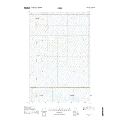
2019 Map of Cahill Lake
USGS Topo · Published 2019About this map
The wetland landscape of Beltrami and Clearwater counties is meticulously documented in this 2019 survey, dominated by an extensive network of marshes and isolated glacial lakes. The southern portion of the quadrangle serves as the primary focal point for hydrographic features, including Cahill Lake, Miskogineu Lake, and Curtis Lake. These water bodies are connected by a sparse infrastructure of rural routes such as Reservation Rd 22 and Resvn Hwy 23, which navigate the saturated terrain. The map's layout highlights the section lines and township boundaries of T154N, T153N, and T152N, illustrating the systematic land division used in this part of Minnesota. This survey provides a modern baseline for the hydrologic state of these northern wetlands, tracing the relationship between public land survey boundaries and the natural topography of the Richards Lake and Roosevelt Lake vicinities.
Find a feature on this map
17 named features on this map. Tap any name to fly to it.
Don’t see what you’re looking for? This feature index may not catch every label — zoom into the map to look around manually.
Map Details
Editions of this 2019 Cahill Lake Map
This is the sole edition of this map. No revisions or reprints were ever made.
Other maps of this area

1918 · Jelle
USGS Topo · 1:62,500

1919 · Churnes
USGS Topo · 1:62,500

1919 · Winsor
USGS Topo · 1:62,500

1954 · Bemidji
USGS Topo · 1:250,000

1954 · Roseau
USGS Topo · 1:250,000

1957 · Roseau
USGS Topo · 1:250,000

1957 · Bemidji
USGS Topo · 1:250,000

1958 · Bemidji
USGS Topo · 1:250,000

1958 · Roseau
USGS Topo · 1:250,000
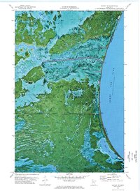
1972 · Berner NE
USGS Topo · 1:24,000