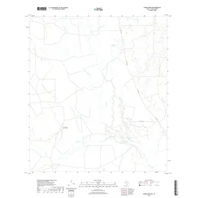
2019 Map of Caiman Creek NE
USGS Topo · Published 2019About this map
The Nueces River winds through this South Texas landscape in La Salle County, defining a region where water sources are the primary landmarks. Significant hydrologic features like Charco Largo Spring and smaller water bodies such as Coquat Lake and Hillje Lake Number 2 break the arid brushland. The drainage network is further mapped through seasonal watercourses including Las Raices Cr, Caiman Cr, and Charco Marrano Cr. Human infrastructure is sparse, characterized by long-distance ranch routes like Los Cuernos Rd and Ranch Rd 624. The presence of the Los Cuernos Ranch Airport indicates the reliance on private aviation for managing these large-scale landholdings in the 21st century.
Find a feature on this map
11 named features on this map. Tap any name to fly to it.
Don’t see what you’re looking for? This feature index may not catch every label — zoom into the map to look around manually.
Map Details
Editions of this 2019 Caiman Creek NE Map
This is the sole edition of this map. No revisions or reprints were ever made.
Other maps of this area

1929 · Cotulla
USGS Topo · 1:125,000

1940 · Cotulla
USGS Topo · 1:62,500

1942 · Fowlerton
USGS Topo · 1:62,500

1953 · Crystal City
USGS Topo · 1:250,000

1955 · Crystal City
USGS Topo · 1:250,000

1956 · Piedra Creek
USGS Topo · 1:62,500

1956 · Fowlerton
USGS Topo · 1:62,500

1957 · Caiman Creek
USGS Topo · 1:62,500

1961 · Crystal City
USGS Topo · 1:250,000

1968 · Crystal City
USGS Topo · 1:250,000