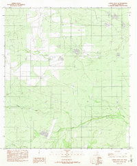
1982 Map of Caiman Creek NW
USGS Topo · Published 1982About this map
Caiman Creek and its southern tributaries wind through the south Texas brush country in this 1982 survey of La Salle County. The landscape is primarily defined by its drainage patterns and water management features, including a prominent Levee and several small tanks or ponds characteristic of cattle ranching territory. Human infrastructure is sparse but functional, centered around a private Landing Strip and a significant Pipeline corridor that cuts across the northern landscape. The network of unimproved roads and fences implies a region of large-scale ranch holdings where Chucareto Creek and Tecolote Creek serve as critical natural landmarks. This provisional map records a specific moment in the land's utility before further energy or ranching developments altered the rural South Texas terrain.
Find a feature on this map
6 named features on this map. Tap any name to fly to it.
Don’t see what you’re looking for? This feature index may not catch every label — zoom into the map to look around manually.
Map Details
Editions of this 1982 Caiman Creek NW Map
This is the sole edition of this map. No revisions or reprints were ever made.
Other maps of this area

1927 · Bart
USGS Topo · 1:62,500

1929 · Cotulla
USGS Topo · 1:125,000

1940 · Cotulla
USGS Topo · 1:62,500

1940 · Artesia Wells
USGS Topo · 1:62,500

1953 · Crystal City
USGS Topo · 1:250,000

1955 · Crystal City
USGS Topo · 1:250,000

1957 · Encinal
USGS Topo · 1:62,500

1957 · Caiman Creek
USGS Topo · 1:62,500

1961 · Crystal City
USGS Topo · 1:250,000

1968 · Crystal City
USGS Topo · 1:250,000