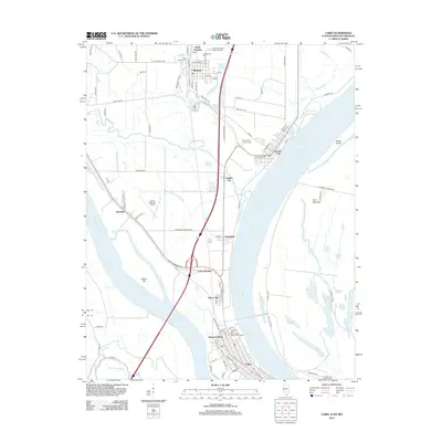
2012 Map of Cairo
USGS Topo · Published 2012About this map
The confluence of the Mississippi River and the Ohio River defines this landscape, where the southern tip of Illinois meets the water. At the heart of the peninsula, Cairo sits protected by an extensive levee system, showing a dense street grid that includes Walnut St and Park Ave. The region's complex hydrology is visible through the numerous backwaters and lakes, such as First Lake, Second Lake, and Grassy Lake, which flank the riverbanks.
Find a feature on this map
74 named features on this map. Tap any name to fly to it.
Don’t see what you’re looking for? This feature index may not catch every label — zoom into the map to look around manually.
Map Details
Editions of this 2012 Cairo Map
This is the sole edition of this map. No revisions or reprints were ever made.
Other maps of this area

1931 · Cairo
USGS Topo · 1:62,500

1933 · Cairo
USGS Topo · 1:62,500

1934 · Thebes
USGS Topo · 1:62,500

1939 · Wickliffe
USGS Topo · 1:62,500

1939 · Charleston
USGS Topo · 1:62,500

1939 · Cairo
USGS Topo · 1:62,500

1939 · Thebes
USGS Topo · 1:62,500

1949 · Paducah
USGS Topo · 1:250,000

1950 · Paducah
USGS Topo · 1:250,000

1951 · Wickliffe
USGS Topo · 1:24,000