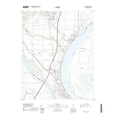
2021 Map of Cairo
USGS Topo · Published 2021About this map
The Ohio River and Mississippi River converge at the southernmost tip of Illinois, defining a landscape shaped by massive water systems and historical river commerce. Cairo occupies the strategic peninsula where these two great rivers meet, its streets laid out in a dense grid near the Alexander County Courthouse. To the north, the geography is marked by a series of settlements including Future City, Urbandale, and Mound City, the latter of which serves as the site for the Pulaski County Courthouse and the sprawling Mound City National Cemetery.
Find a feature on this map
110 named features on this map. Tap any name to fly to it.
Don’t see what you’re looking for? This feature index may not catch every label — zoom into the map to look around manually.
Map Details
Editions of this 2021 Cairo Map
This is the sole edition of this map. No revisions or reprints were ever made.
Other maps of this area

1931 · Cairo
USGS Topo · 1:62,500

1933 · Cairo
USGS Topo · 1:62,500

1934 · Thebes
USGS Topo · 1:62,500

1939 · Wickliffe
USGS Topo · 1:62,500

1939 · Charleston
USGS Topo · 1:62,500

1939 · Cairo
USGS Topo · 1:62,500

1939 · Thebes
USGS Topo · 1:62,500

1949 · Paducah
USGS Topo · 1:250,000

1950 · Paducah
USGS Topo · 1:250,000

1951 · Wickliffe
USGS Topo · 1:24,000