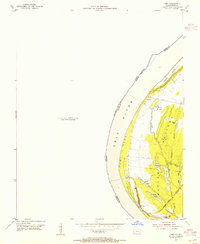
1954 Map of Cairo
USGS Topo · Published 1955About this map
Ohio River hydrology dominates this mid-century survey of the river's Kentucky bank, specifically the alluvial lowlands of the Barlow Bottoms. The landscape is a complex network of wetlands and oxbow remnants, featuring a series of named water bodies including First Lake, Second Lake, Grassy Lake, and Minor Lake. These are interconnected by a system of sloughs such as Sandy Slough, Cypress Slough, and Minor Slough, illustrating the dynamic nature of the river plain before significant modern modification.
Find a feature on this map
25 named features on this map. Tap any name to fly to it.
Don’t see what you’re looking for? This feature index may not catch every label — zoom into the map to look around manually.
Map Details
Editions of this 1954 Cairo Map
This is the sole edition of this map. No revisions or reprints were ever made.
Other maps of this area

1931 · Cairo
USGS Topo · 1:62,500

1933 · Cairo
USGS Topo · 1:62,500

1934 · Thebes
USGS Topo · 1:62,500

1939 · Wickliffe
USGS Topo · 1:62,500

1939 · Charleston
USGS Topo · 1:62,500

1939 · Cairo
USGS Topo · 1:62,500

1939 · Thebes
USGS Topo · 1:62,500

1949 · Paducah
USGS Topo · 1:250,000

1950 · Paducah
USGS Topo · 1:250,000

1951 · Wickliffe
USGS Topo · 1:24,000