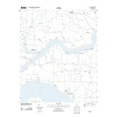
2011 Map of Cairo
USGS Topo · Published 2011About this map
Wheeler Lake and the winding course of the Elk River dominate this early 21st-century landscape in Lauderdale County. The area is characterized by riverside residential developments such as Elk Shores, Dogwood, and Anderson Creek Subdivision, reflecting a shift toward recreational and waterfront living along the Tennessee River system. The map is particularly rich for genealogical research, documenting numerous family burial grounds including the Sandlin Cemetery, Temperance Oak Cemetery, and Ripley Cemetery.
Find a feature on this map
149 named features on this map. Tap any name to fly to it.
Don’t see what you’re looking for? This feature index may not catch every label — zoom into the map to look around manually.
Map Details
Editions of this 2011 Cairo Map
This is the sole edition of this map. No revisions or reprints were ever made.
Other maps of this area

1914 · Rogersville
USGS Topo · 1:48,000

1916 · Rogersville
USGS Topo · 1:62,500

1936 · Union Hill
USGS Topo · 1:24,000

1936 · Thorntontown
USGS Topo · 1:24,000

1936 · Stewart Cross Roads
USGS Topo · 1:24,000

1936 · Courtland
USGS Topo · 1:24,000

1936 · Lexington
USGS Topo · 1:24,000

1936 · Ripley
USGS Topo · 1:24,000

1936 · Hillsboro
USGS Topo · 1:24,000

1936 · Cairo
USGS Topo · 1:24,000