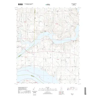
2018 Map of Cairo
USGS Topo · Published 2018About this map
Wheeler Reservoir and the wide expanse of the Elk River dominate this landscape where Lauderdale, Limestone, and Lawrence counties meet. The terrain is defined by dramatic bluffs and hollows, including Buzzard Roost Bluff and Bald Eagle Hollow, which overlook the submerged river valley. The map reveals a dense network of family history markers, with numerous burial grounds such as Lentzville Cem, Townsend Cem, and Bedingfield Cem scattered across the uplands. Small settlements like Rogersville, Lentzville, and Coxey serve as anchors for the rural road system. This survey illustrates how the impoundment of the Tennessee River has shaped local geography, creating significant inlets along Dement Br and Anderson Creek while preserving the high-ground cemeteries of the early farming communities.
Find a feature on this map
155 named features on this map. Tap any name to fly to it.
Don’t see what you’re looking for? This feature index may not catch every label — zoom into the map to look around manually.
Map Details
Editions of this 2018 Cairo Map
This is the sole edition of this map. No revisions or reprints were ever made.
Other maps of this area

1914 · Rogersville
USGS Topo · 1:48,000

1916 · Rogersville
USGS Topo · 1:62,500

1936 · Union Hill
USGS Topo · 1:24,000

1936 · Thorntontown
USGS Topo · 1:24,000

1936 · Stewart Cross Roads
USGS Topo · 1:24,000

1936 · Courtland
USGS Topo · 1:24,000

1936 · Lexington
USGS Topo · 1:24,000

1936 · Ripley
USGS Topo · 1:24,000

1936 · Hillsboro
USGS Topo · 1:24,000

1936 · Cairo
USGS Topo · 1:24,000