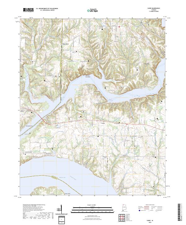
2024 Map of Cairo
USGS Topo · Published 2024About this map
Wheeler Lake and the Tennessee River dominate the southern landscape of this northern Alabama region, where the water's edge meets a complex network of creeks and branches. The terrain is marked by distinctive bluffs such as Buzzard Roost Bluff and Melton Bluff, which overlook the expansive Wheeler Reservoir. The settlement pattern reflects a long-standing rural community structure, with small centers like Cedar Grove and Lentzville connected by a web of county roads. A high density of family and community burial sites, including the Higgins Cem and Lentzville Cem, points to the deep genealogical roots of the area. Notable landmarks like the Bedingfield Ferry and the Beechwood Airpark illustrate the evolution of local transportation, from river crossings to small-scale aviation. The northern reaches are defined by numerous waterways like Anderson Creek and Maple Swamp Branch, which have shaped the agricultural and residential development of the quadrangle.
Find a feature on this map
171 named features on this map. Tap any name to fly to it.
Don’t see what you’re looking for? This feature index may not catch every label — zoom into the map to look around manually.
Map Details
Editions of this 2024 Cairo Map
This is the sole edition of this map. No revisions or reprints were ever made.
Other maps of this area

1914 · Rogersville
USGS Topo · 1:48,000

1916 · Rogersville
USGS Topo · 1:62,500

1936 · Union Hill
USGS Topo · 1:24,000

1936 · Thorntontown
USGS Topo · 1:24,000

1936 · Stewart Cross Roads
USGS Topo · 1:24,000

1936 · Courtland
USGS Topo · 1:24,000

1936 · Lexington
USGS Topo · 1:24,000

1936 · Ripley
USGS Topo · 1:24,000

1936 · Hillsboro
USGS Topo · 1:24,000

1936 · Cairo
USGS Topo · 1:24,000