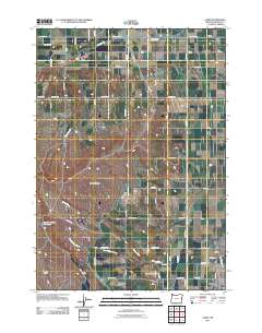
2011 Map of Cairo
USGS Topo · Published 2011About this map
The agricultural landscape of Malheur County is defined by an intricate network of irrigation, including the Ontario Nyssa Canal, Owyhee Ditch, and Nevada Canal. These water systems cut across the high ground of Lincoln Bench and the open expanses of Big Sage Flats, facilitating the transition from arid terrain to a productive farming district. The map captures the northern outskirts of Nyssa and the surrounding rural communities like Nyssa Heights and the curiously named White Settlement.
Find a feature on this map
52 named features on this map. Tap any name to fly to it.
Don’t see what you’re looking for? This feature index may not catch every label — zoom into the map to look around manually.
Map Details
Editions of this 2011 Cairo Map
This is the sole edition of this map. No revisions or reprints were ever made.
Other maps of this area
1897 · Weiser
USGS Topo · 1:125,000
1898 · Nampa
USGS Topo · 1:125,000
1906 · Mitchell Butte
USGS Topo · 1:125,000
1951 · Malheur Butte
USGS Topo · 1:24,000
1951 · Moores Hollow
USGS Topo · 1:62,500
1951 · Payette
USGS Topo · 1:24,000
1955 · Baker
USGS Topo · 1:250,000
1955 · Boise
USGS Topo · 1:250,000
1958 · Boise
USGS Topo · 1:250,000
1959 · Baker
USGS Topo · 1:250,000