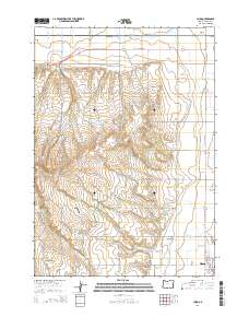
2014 Map of Cairo
USGS Topo · Published 2014About this map
The agricultural landscape of eastern Malheur County is defined here by a sophisticated network of water management features, including the Nevada Canal and the Ontario Nyssa Canal. This irrigation infrastructure supports the settlements of Cairo and Nyssa, while the surrounding terrain rises toward the Lincoln Bench and the broad Big Sage Flats. Water transport is central to the area's geography, evidenced by the Malheur Siphon and various named ditches such as the Stewart Carter Ditch and Owyhee Ditch that weave through the valley. Local history is anchored by the Nyssa Cemetery, situated just south of Sarazin Road. The presence of small water bodies like Albertsons Reservoir 'A' and Lincoln Bench Reservoir highlights the intensive land use required for high-desert farming near the Snake River valley.
Find a feature on this map
56 named features on this map. Tap any name to fly to it.
Don’t see what you’re looking for? This feature index may not catch every label — zoom into the map to look around manually.
Map Details
Editions of this 2014 Cairo Map
This is the sole edition of this map. No revisions or reprints were ever made.
Other maps of this area

1897 · Weiser
USGS Topo · 1:125,000

1898 · Nampa
USGS Topo · 1:125,000

1906 · Mitchell Butte
USGS Topo · 1:125,000

1951 · Malheur Butte
USGS Topo · 1:24,000

1951 · Moores Hollow
USGS Topo · 1:62,500

1951 · Payette
USGS Topo · 1:24,000

1955 · Baker
USGS Topo · 1:250,000

1955 · Boise
USGS Topo · 1:250,000

1958 · Boise
USGS Topo · 1:250,000

1959 · Baker
USGS Topo · 1:250,000