
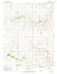
1967 Map of Cairo
USGS Topo · Published 1969About this map
The South Fork Ninnescah River meanders across this Central Kansas landscape, anchoring a region defined by agriculture, resource extraction, and early rail lines. In the late 1960s, the small community of Cairo stands alongside the Atchison Topeka and Santa Fe railroad, supported by the nearby Cairo Cem and a local Fish Hatchery. The map reveals a transition from traditional farming to industrial energy production, evidenced by the Barnes Southwest Oil Field and scattered Gas Wells and Oil Wells. To the north, the Chicago Rock Island and Pacific railroad cuts through the township of Haynesville, following the path of Silver Creek. Small settlements like Waldeck and landmarks like the Roadside Park reflect the sparse but deliberate development of Pratt County during this era of mid-century growth.
Find a feature on this map
23 named features on this map. Tap any name to fly to it.
Don’t see what you’re looking for? This feature index may not catch every label — zoom into the map to look around manually.
Map Details
Editions of this 1967 Cairo Map
This is the sole edition of this map. No revisions or reprints were ever made.
Other maps of this area

1892 · Kingman
USGS Topo · 1:125,000

1892 · Pratt
USGS Topo · 1:125,000

1894 · Kingman
USGS Topo · 1:125,000

1894 · Pratt
USGS Topo · 1:125,000

1955 · Pratt
USGS Topo · 1:250,000

1959 · Pratt
USGS Topo · 1:250,000

1966 · Cunningham
USGS Topo · 1:24,000
1966 · St Leo
USGS Topo · 1:24,000

1968 · Pratt SW
USGS Topo · 1:24,000

1968 · Pratt
USGS Topo · 1:24,000