
1933 Map of Cairo
USGS Topo · Published 1933About this map
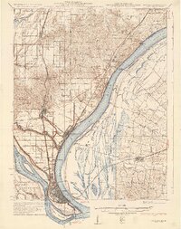
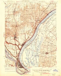
Cairo, Illinois, sits at the strategic confluence where the Mississippi River and Ohio River meet, forming a dense urban grid protected by an extensive levee system. This era reveals a landscape defined by water and heavy rail, with the Illinois Central and Mobile and Ohio railroads converging on the tip of the peninsula. North of the main city, industrial and residential satellite settlements like Future City and Irvindale are visible, while the National Cem at Mound City marks a significant local landmark.
Find a feature on this map
106 named features on this map. Tap any name to fly to it.
Don’t see what you’re looking for? This feature index may not catch every label — zoom into the map to look around manually.
Map Details
Editions of this 1933 Cairo Map
3 editions found
Other maps of this area

1918 · Vienna
USGS Topo · 1:62,500

1919 · Vienna
USGS Topo · 1:62,500

1920 · Jonesboro
USGS Topo · 1:62,500

1920 · Dongola
USGS Topo · 1:62,500

1923 · Dongola
USGS Topo · 1:62,500

1923 · Jonesboro
USGS Topo · 1:62,500

1928 · La Center
USGS Topo · 1:62,500

1931 · Cairo
USGS Topo · 1:62,500

1932 · La Center
USGS Topo · 1:62,500

1934 · Thebes
USGS Topo · 1:62,500