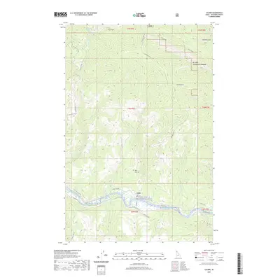
2020 Map of Calder
USGS Topo · Published 2020About this map
Calder serves as the central hub for this portion of the St. Joe National Forest, situated along the winding course of the Saint Joe Wild and Scenic River. The settlement is defined by its relationship with the water and the complex logging and access routes that permeate the surrounding mountains. Significant elevation changes are marked by distinctive landmarks such as Lemonade Peak, Spooky Butte, and Billy Goat Hill. The landscape is deeply dissected by a dense network of drainages, including Trout Creek, Mica Creek, and Jack Cr, which feed into the main river channel. Transport is dictated by the river valley, with St Joe River Rd and Potlatch Rd providing critical connections through this timbered territory. The map illustrates a contemporary view of the region's managed forest lands and the persistent importance of the river corridor for both travel and geographic orientation.
Find a feature on this map
43 named features on this map. Tap any name to fly to it.
Don’t see what you’re looking for? This feature index may not catch every label — zoom into the map to look around manually.
Map Details
Editions of this 2020 Calder Map
This is the sole edition of this map. No revisions or reprints were ever made.
Other maps of this area

1950 · Twin Crags
USGS Topo · 1:24,000

1952 · Twin Crags
USGS Topo · 1:24,000

1955 · Spokane
USGS Topo · 1:250,000

1957 · Calder
USGS Topo · 1:62,500

1957 · St. Joe
USGS Topo · 1:62,500

1958 · Spokane
USGS Topo · 1:250,000

1961 · Fernwood
USGS Topo · 1:62,500

1969 · Marble Mountain
USGS Topo · 1:24,000

1969 · Huckleberry Mtn
USGS Topo · 1:24,000

1981 · St Maries
USGS Topo · 1:100,000