
1961 Map of Fernwood
USGS Topo · Published 1963About this map
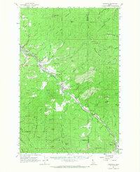
The St Maries River valley serves as the central artery for this 1961 survey, where the Chicago Milwaukee St Paul and Pacific railroad parallels the water to support the region's timber and transport economy. Small settlements and sidings like Fernwood, Santa, and Mashburn are spaced along the rail line, marking the human footprint within the expansive St Joe National Forest. The map captures the industrial character of the era through features like the Gravel Pit near Renfrew and Tailings piles along Emerald Creek, while the presence of a Cem near Santa and a Ranger Sta in Clarkia highlights the established community infrastructure. Elevated terrain such as Pettis Peak and Blackwell Hump overlook a landscape carved by numerous waterways including Beaver Creek and Mica Creek, illustrating the complex drainage patterns of the Benewah and Shoshone county borderlands.
Find a feature on this map
76 named features on this map. Tap any name to fly to it.
Don’t see what you’re looking for? This feature index may not catch every label — zoom into the map to look around manually.
Map Details
Editions of this 1961 Fernwood Map
2 editions found
Other maps of this area

1955 · Pullman
USGS Topo · 1:250,000

1955 · Spokane
USGS Topo · 1:250,000

1957 · St. Maries
USGS Topo · 1:62,500

1957 · Emida
USGS Topo · 1:62,500

1957 · Calder
USGS Topo · 1:62,500

1957 · St. Joe
USGS Topo · 1:62,500

1958 · Spokane
USGS Topo · 1:250,000

1958 · Pullman
USGS Topo · 1:250,000

1961 · Deary
USGS Topo · 1:62,500

1961 · Bovill
USGS Topo · 1:62,500