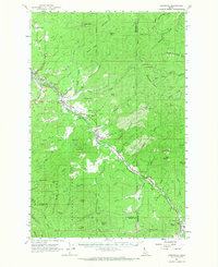
1961 Map of Fernwood
USGS Topo · Published 1968About this map
Fernwood and the winding course of the Chicago Milwaukee St Paul and Pacific railroad define the industrial and social geography of this Northern Idaho landscape. Surveyed in the late 1950s and early 1960s, the map reveals a region deeply tied to timber and transit, with small settlements like Santa and Clarkia positioned along the rail lines and major creek drainages. High peaks such as Crystal Peak and Pettis Peak dominate the skyline of the St Joe National Forest, where a network of trails and jeep tracks connects remote landmarks like the Renfrew Cemetery and the Ranger Station. The drainage patterns of Emerald Creek and Beaver Creek are intricately mapped, showing the complex terrain that historically supported mining and logging, evidenced by features such as the Tailings near Cedar Butte and several gravel pits scattered near the rail corridors.
Find a feature on this map
80 named features on this map. Tap any name to fly to it.
Don’t see what you’re looking for? This feature index may not catch every label — zoom into the map to look around manually.
Map Details
Editions of this 1961 Fernwood Map
2 editions found
Other maps of this area

1955 · Pullman
USGS Topo · 1:250,000

1955 · Spokane
USGS Topo · 1:250,000

1957 · St. Maries
USGS Topo · 1:62,500

1957 · Emida
USGS Topo · 1:62,500

1957 · Calder
USGS Topo · 1:62,500

1957 · St. Joe
USGS Topo · 1:62,500

1958 · Spokane
USGS Topo · 1:250,000

1958 · Pullman
USGS Topo · 1:250,000

1961 · Deary
USGS Topo · 1:62,500

1961 · Fernwood
USGS Topo · 1:62,500