
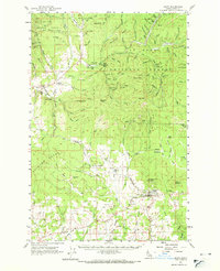
1961 Map of Deary
USGS Topo · Published 1963About this map
Deary and the surrounding Latah County landscape appear here in the early 1960s, a region defined by its timbered ridges and a peculiar cluster of collegiate-named settlements. The Washington Idaho and Montana railroad serves as the primary artery through the southern portion of the quadrangle, connecting Avon and Deary to the wider region. In the northern reaches, the St Joe National Forest dominates the terrain, with industrial activity evidenced by the Gold Bug Mine, Gold Hill Mine, and various operations like the Luella Mine and Last Chance Mine. This survey preserves the locations of local landmarks such as Woodfell Cem, Zion Cem, and Dry Creek Cem, alongside unique social sites like Camp Grizzly and Laird Park. The nomenclature of the area is particularly striking, featuring towns named Harvard, Yale, Stanford, and Vassar, reflecting a distinctive cultural stamp on the Idaho panhandle's rugged geography.
Find a feature on this map
113 named features on this map. Tap any name to fly to it.
Don’t see what you’re looking for? This feature index may not catch every label — zoom into the map to look around manually.
Map Details
Editions of this 1961 Deary Map
2 editions found
Other maps of this area

1955 · Pullman
USGS Topo · 1:250,000

1955 · Spokane
USGS Topo · 1:250,000

1957 · Emida
USGS Topo · 1:62,500

1957 · Tensed
USGS Topo · 1:62,500

1958 · Spokane
USGS Topo · 1:250,000

1958 · Pullman
USGS Topo · 1:250,000

1960 · Troy
USGS Topo · 1:24,000

1960 · Moscow Mtn
USGS Topo · 1:24,000

1960 · Potlatch
USGS Topo · 1:62,500

1961 · Kendrick
USGS Topo · 1:62,500