
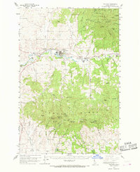
1960 Map of Potlatch
USGS Topo · Published 1962About this map
The Washington Idaho and Montana Railway anchors this 1960s landscape, tracing the Potlatch River through a series of mill-driven timber towns. Settlements like Onaway, Potlatch, and Princeton line the river valley, while the northern reaches transition into the managed timberlands of the St Joe National Forest. The map captures the industrial character of Latah County at this time, documenting the infrastructure required for high-altitude logging and transport.
Find a feature on this map
68 named features on this map. Tap any name to fly to it.
Don’t see what you’re looking for? This feature index may not catch every label — zoom into the map to look around manually.
Map Details
Editions of this 1960 Potlatch Map
2 editions found
Other maps of this area

1903 · Oakesdale
USGS Topo · 1:125,000

1905 · Oakesdale
USGS Topo · 1:125,000

1910 · Pullman
USGS Topo · 1:125,000

1955 · Pullman
USGS Topo · 1:250,000

1955 · Spokane
USGS Topo · 1:250,000

1957 · Emida
USGS Topo · 1:62,500

1957 · Tensed
USGS Topo · 1:62,500

1958 · Spokane
USGS Topo · 1:250,000

1958 · Pullman
USGS Topo · 1:250,000

1960 · Troy
USGS Topo · 1:24,000