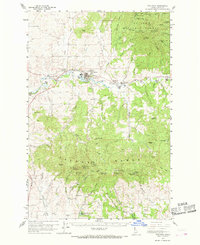
1960 Map of Potlatch
USGS Topo · Published 1968About this map
The timber and transit corridor of the Palouse River valley anchors this mid-century survey, dominated by the industrial and community hub of Potlatch. Here, the Washington Idaho and Montana RR tracks parallel the river, connecting a series of smaller settlements including Onaway, Princeton, and Hampton. The map records a landscape transitioning from the active milling and rail activity of the valley floor to the dense high country of the St Joe National Forest and the Palouse Range. Higher elevations are marked by lookout points like Rocky Point Lookout and Gold Hill Lookout, while the southern slopes of the range feature landmarks such as the White Cross Mine and the Radio Facility near West Twin. Local social geography is preserved through details like the Grange Hall at Kennedy Ford and the Beulah Ch to the south, reflecting the area's agricultural and communal roots.
Find a feature on this map
81 named features on this map. Tap any name to fly to it.
Don’t see what you’re looking for? This feature index may not catch every label — zoom into the map to look around manually.
Map Details
Editions of this 1960 Potlatch Map
2 editions found

Other maps of this area

1903 · Oakesdale
USGS Topo · 1:125,000

1905 · Oakesdale
USGS Topo · 1:125,000

1910 · Pullman
USGS Topo · 1:125,000

1955 · Pullman
USGS Topo · 1:250,000

1955 · Spokane
USGS Topo · 1:250,000

1957 · Emida
USGS Topo · 1:62,500

1957 · Tensed
USGS Topo · 1:62,500

1958 · Spokane
USGS Topo · 1:250,000

1958 · Pullman
USGS Topo · 1:250,000

1960 · Troy
USGS Topo · 1:24,000