
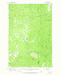
1961 Map of Bovill
USGS Topo · Published 1963About this map
Bovill serves as the central hub of this northern Idaho landscape, where the timber and rail industries converge along the Potlatch River. The town is defined by its industrial infrastructure, including Settling Tanks, Claypits, and a nearby Airstrip. The Chicago Milwaukee St Paul and Pacific railroad, also labeled here as the Milwaukee Road, winds through the river valleys, connecting the settlement of Helmer to the surrounding hills.
Find a feature on this map
91 named features on this map. Tap any name to fly to it.
Don’t see what you’re looking for? This feature index may not catch every label — zoom into the map to look around manually.
Map Details
Editions of this 1961 Bovill Map
2 editions found
Other maps of this area

1955 · Pullman
USGS Topo · 1:250,000

1955 · Spokane
USGS Topo · 1:250,000

1957 · Emida
USGS Topo · 1:62,500

1958 · Spokane
USGS Topo · 1:250,000

1958 · Pullman
USGS Topo · 1:250,000

1961 · Deary
USGS Topo · 1:62,500

1961 · Kendrick
USGS Topo · 1:62,500

1961 · Ahsahka
USGS Topo · 1:62,500

1961 · Fernwood
USGS Topo · 1:62,500

1969 · Elk River
USGS Topo · 1:24,000