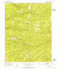
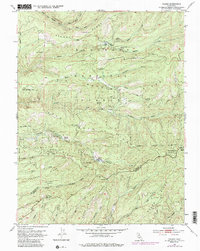
1951 Map of Caldor
USGS Topo · Published 1956About this map
Caldor stands as a central industrial and administrative node within the Eldorado National Forest in this early 1950s survey. The map details a landscape defined by timber extraction and mineral exploration, notably marked by the presence of a logging road network and the Caldor Ranger Sta. Mining activity is dispersed across the ridges, including the Spread Eagle Mine and Arbor Mine near the settlement, while the Red Gold Mine is situated further west. The topography is characterized by major drainages like the North Fork Cosumnes River and Middle Fork Cosumnes River, which carve through prominent landforms such as Plummer Ridge and Big Mountain. This document captures the mid-century infrastructure of the Sierra Nevada foothills, including fire suppression sites like the Dew Drop Fire Control Station and the Fort Grizzly Site along the southern border between El Dorado and Amador counties.
Find a feature on this map
48 named features on this map. Tap any name to fly to it.
Don’t see what you’re looking for? This feature index may not catch every label — zoom into the map to look around manually.
Map Details
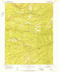
Editions of this 1951 Caldor Map
5 editions found
Other maps of this area

1889 · Jackson
USGS Topo · 1:125,000

1889 · Pyramid Peak
USGS Topo · 1:125,000

1891 · Big Trees
USGS Topo · 1:125,000

1891 · Placerville
USGS Topo · 1:125,000

1891 · Pyramid Peak
USGS Topo · 1:125,000

1892 · Jackson
USGS Topo · 1:125,000

1892 · Placerville
USGS Topo · 1:125,000

1893 · Placerville
USGS Topo · 1:125,000

1894 · Big Trees
USGS Topo · 1:125,000

1895 · Pyramid Peak
USGS Topo · 1:125,000