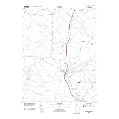
2010 Map of Caldwell North
USGS Topo · Published 2010About this map
West Fork Duck Creek serves as the central drainage for this section of Noble County, where the Interstate 77 corridor parallels the waterway through a landscape defined by small valley settlements and ridge-top cemeteries. The industrial history of the region is evident in the Coal Ridge area and the Central Ohio Coal Company Nb-151 Reservoir, indicating a landscape shaped by resource extraction. The community of Belle Valley and the Ava Post Office anchor the local geography, while the Noble County Airport occupies a level stretch near Wolf Run Lake. Local history is preserved in numerous family and community burial grounds, such as Halleys Ridge Cemetery and Saint Michaels Cemetery, which are scattered among the many named hills and hollows like Johnny Woods River and Patty Creek.
Find a feature on this map
113 named features on this map. Tap any name to fly to it.
Don’t see what you’re looking for? This feature index may not catch every label — zoom into the map to look around manually.
Map Details
Editions of this 2010 Caldwell North Map
This is the sole edition of this map. No revisions or reprints were ever made.
Other maps of this area

1903 · Macksburg
USGS Topo · 1:62,500

1905 · Macksburg
USGS Topo · 1:62,500

1909 · Caldwell
USGS Topo · 1:62,500

1909 · Summerfield
USGS Topo · 1:62,500

1911 · Cumberland
USGS Topo · 1:62,500

1911 · Summerfield
USGS Topo · 1:62,500

1912 · Caldwell
USGS Topo · 1:62,500

1949 · Clarksburg
USGS Topo · 1:250,000

1956 · Clarksburg
USGS Topo · 1:250,000

1961 · Clarksburg
USGS Topo · 1:250,000