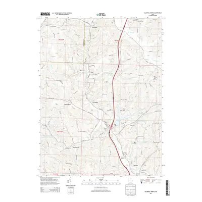
2013 Map of Caldwell North
USGS Topo · Published 2013About this map
Belle Valley serves as a central hub in this section of Noble County, where the Interstate 77 corridor intersects with local history. The landscape is defined by the winding course of the W Fork Duck Cr and the expansive recreation area at Wolf Run State Park, featuring Wolf Run Lake. The map reveals a high density of rural cemeteries, including Saint Michaels Cem and the Mt Zion Lutheran Cem, which indicate long-standing family settlements across the ridgelines. To the west, the Central Ohio Coal Company Nb-151 Reservoir highlights the area's industrial footprint. Small settlements like Hiramsburg, Ava, and Hoskinsville are connected by a network of ridge roads and valley routes such as Marietta Rd and Belle Valley Rd, illustrating the traditional Appalachian plateau land-use patterns where development follows the drainage systems.
Find a feature on this map
74 named features on this map. Tap any name to fly to it.
Don’t see what you’re looking for? This feature index may not catch every label — zoom into the map to look around manually.
Map Details
Editions of this 2013 Caldwell North Map
This is the sole edition of this map. No revisions or reprints were ever made.
Other maps of this area

1903 · Macksburg
USGS Topo · 1:62,500

1905 · Macksburg
USGS Topo · 1:62,500

1909 · Caldwell
USGS Topo · 1:62,500

1909 · Summerfield
USGS Topo · 1:62,500

1911 · Cumberland
USGS Topo · 1:62,500

1911 · Summerfield
USGS Topo · 1:62,500

1912 · Caldwell
USGS Topo · 1:62,500

1949 · Clarksburg
USGS Topo · 1:250,000

1956 · Clarksburg
USGS Topo · 1:250,000

1961 · Clarksburg
USGS Topo · 1:250,000