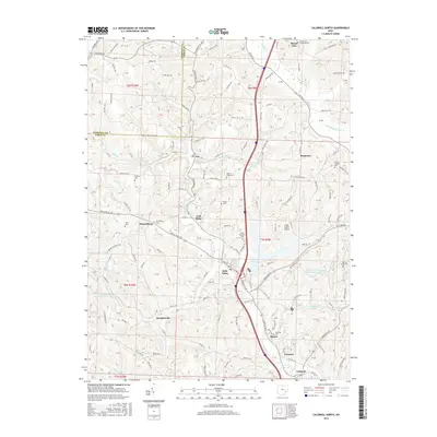
2016 Map of Caldwell North
USGS Topo · Published 2016About this map
Belle Valley and the surrounding townships of Noble County are defined by a complex network of ridges and watercourses in this 2016 record. The landscape is marked by the Johnny Woods River and W Fork Duck Cr, which carve through the terrain near established settlements like Coal Ridge and Ava. To the west, the Central Ohio Coal Company No. 151 Reservoir and several family-named cemeteries, such as McElroy Cem and Scott Cem, indicate the area's agricultural and industrial history. The presence of the Eastern Ohio Research Development Center Pond and the Noble County Airport near Rochester show the modern infrastructure integrated into this rural Ohio corridor. Local genealogists will find significant value in the distribution of burial grounds, including Mount Zion Lutheran Cem and Barrys Ridge Cem, scattered across the higher elevations of Halleys Ridge.
Find a feature on this map
121 named features on this map. Tap any name to fly to it.
Don’t see what you’re looking for? This feature index may not catch every label — zoom into the map to look around manually.
Map Details
Editions of this 2016 Caldwell North Map
This is the sole edition of this map. No revisions or reprints were ever made.
Other maps of this area

1903 · Macksburg
USGS Topo · 1:62,500

1905 · Macksburg
USGS Topo · 1:62,500

1909 · Caldwell
USGS Topo · 1:62,500

1909 · Summerfield
USGS Topo · 1:62,500

1911 · Cumberland
USGS Topo · 1:62,500

1911 · Summerfield
USGS Topo · 1:62,500

1912 · Caldwell
USGS Topo · 1:62,500

1949 · Clarksburg
USGS Topo · 1:250,000

1956 · Clarksburg
USGS Topo · 1:250,000

1961 · Clarksburg
USGS Topo · 1:250,000