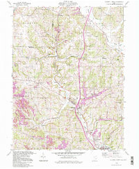
1994 Map of Caldwell North
USGS Topo · Published 1998About this map
Wolf Run State Park anchors the central landscape of this Noble County survey, dominated by the valley of West Fork Duck Creek. The region’s industrial history is etched into the terrain through numerous Strip Mines and Kilns, particularly around Coal Ridge and Hiramsburg. This extractive legacy sits alongside a network of small, established rural communities such as Belle Valley, Ava, and Glenwood, each connected by winding roads through the narrow creek bottoms. Genealogists and local historians will find several well-defined burial sites including McElroy Cem, Jennings Cem, and the Scott Cem. Religious life is documented by the presence of landmarks like St Michaels Ch and Halleys Ridge Ch. The map also captures infrastructure developments like the Noble County Airport, showing how the area balanced its agricultural and industrial roots with late-century modernization.
Find a feature on this map
48 named features on this map. Tap any name to fly to it.
Don’t see what you’re looking for? This feature index may not catch every label — zoom into the map to look around manually.
Map Details
Editions of this 1994 Caldwell North Map
This is the sole edition of this map. No revisions or reprints were ever made.
Other maps of this area

1903 · Macksburg
USGS Topo · 1:62,500

1905 · Macksburg
USGS Topo · 1:62,500

1909 · Caldwell
USGS Topo · 1:62,500

1909 · Summerfield
USGS Topo · 1:62,500

1911 · Cumberland
USGS Topo · 1:62,500

1911 · Summerfield
USGS Topo · 1:62,500

1912 · Caldwell
USGS Topo · 1:62,500

1949 · Clarksburg
USGS Topo · 1:250,000

1956 · Clarksburg
USGS Topo · 1:250,000

1961 · Clarksburg
USGS Topo · 1:250,000