
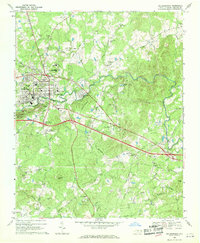
1968 Map of Caldwell
USGS Topo · Published 1970About this map
Little River and its intricate drainage system of forks and creeks define the rural character of northern Orange County in the late 1960s. The landscape is dotted with several named settlements including Caldwell, Walnut Grove, Laws, and Schley, which appear as small clusters of structures at country crossroads. The distribution of spiritual and community centers is particularly dense here, featuring numerous churches such as Olive Chapel, Berrys Grove Ch, Lattisville Grove Ch, and Glengrove Ch.
Find a feature on this map
26 named features on this map. Tap any name to fly to it.
Don’t see what you’re looking for? This feature index may not catch every label — zoom into the map to look around manually.
Map Details
Editions of this 1968 Caldwell Map
This is the sole edition of this map. No revisions or reprints were ever made.
Other maps of this area

1943 · Roxboro
USGS Topo · 1:62,500

1951 · Durham North
USGS Topo · 1:62,500

1953 · Greensboro
USGS Topo · 1:250,000

1954 · Greensboro
USGS Topo · 1:250,000

1962 · Greensboro
USGS Topo · 1:250,000

1966 · Greensboro
USGS Topo · 1:250,000

1967 · Cedar Grove
USGS Topo · 1:24,000

1968 · Efland
USGS Topo · 1:24,000
1968 · Hillsborough
USGS Topo · 1:24,000

1968 · Ridgeville
USGS Topo · 1:24,000