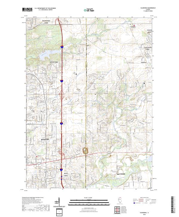
2024 Map of Caledonia
USGS Topo · Published 2024About this map
Caledonia and Argyle sit along the border of Winnebago and Boone counties, marking a transition from suburban expansion to open agricultural land. The landscape is defined by the winding course of Beaver Creek and Willow Creek, which drain toward the Kishwaukee River in the south. This recent survey captures the modern road network, including E Riverside Blvd and E State St, which connect the growing communities of Rockford and Belvidere. Local history remains visible through preserved sites such as the Tripp Pioneer Cem and Davis Cem. Institutional growth is evident near the western edge with the campuses of Rock Valley College and Saint Anthony College of Nursing. The map also details the recreational and residential character of the area, featuring Pierce Lake and the planned community around Candlewick Lake to the northeast.
Find a feature on this map
48 named features on this map. Tap any name to fly to it.
Don’t see what you’re looking for? This feature index may not catch every label — zoom into the map to look around manually.
Map Details
Editions of this 2024 Caledonia Map
This is the sole edition of this map. No revisions or reprints were ever made.
Other maps of this area

1917 · Kings
USGS Topo · 1:62,500

1918 · Rockford
USGS Topo · 1:62,500

1918 · Belvidere
USGS Topo · 1:62,500

1918 · Kings
USGS Topo · 1:62,500

1918 · Kirkland
USGS Topo · 1:62,500

1938 · Rockford
USGS Topo · 1:62,500

1944 · Belvidere
USGS Topo · 1:62,500

1949 · Camp Grant
USGS Topo · 1:24,000

1949 · Rockford
USGS Topo · 1:24,000

1954 · Rockford
USGS Topo · 1:250,000