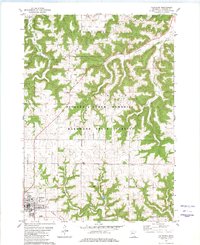
1980 Map of Caledonia
USGS Topo · Published 1980About this map
The county seat of Caledonia anchors the southwestern corner of this survey, characterized by a complex network of ridges and deep drainage basins in Houston County. The landscape is dominated by the Richard J Dorer Memorial Hardwood State Forest, which cloaks the steep slopes of Peacock Ridge and Union Ridge. This terrain, part of the Driftless Area, dictates the winding paths of rural roads and the placement of early infrastructure like the Townhall and several limestone quarries used for local construction.
Find a feature on this map
32 named features on this map. Tap any name to fly to it.
Don’t see what you’re looking for? This feature index may not catch every label — zoom into the map to look around manually.
Map Details
Editions of this 1980 Caledonia Map
This is the sole edition of this map. No revisions or reprints were ever made.
Other maps of this area

1930 · La Crescent
USGS Topo · 1:62,500

1956 · Brownsville
USGS Topo · 1:62,500

1956 · La Crescent
USGS Topo · 1:62,500

1958 · Houston
USGS Topo · 1:62,500

1958 · La Crosse
USGS Topo · 1:250,000

1961 · La Crosse
USGS Topo · 1:250,000

1965 · La Crosse
USGS Topo · 1:250,000

1965 · Wilmington
USGS Topo · 1:24,000

1965 · Sheldon
USGS Topo · 1:24,000
1973 · Mound Prairie
USGS Topo · 1:24,000