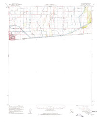
1957 Map of Calexico
USGS Topo · Published 1961About this map
The border city of Calexico anchors this late-1950s survey of the Imperial Valley, where the intricate irrigation network of the All American Canal and the Alamo River defines the landscape. The map reveals the critical infrastructure supporting agriculture along the United States Mexico border, featuring an extensive system of drains and canals such as the Hemlock Canal and East Highline Canal. Local educational history is well-represented through several institutions, including Union High Sch, Rockwood Sch, and the Jasper-Alamitos Sch. Beyond the residential streets of the city, small rural hubs like Bonds Corner and the Labor Camp appear alongside specialized landmarks like the Radio Sta (KICO) and the Mountain View Cem. The transition from the engineered valley floor to the desert is marked by the East Mesa, where a Jeep Trail winds through the arid terrain.
Find a feature on this map
58 named features on this map. Tap any name to fly to it.
Don’t see what you’re looking for? This feature index may not catch every label — zoom into the map to look around manually.
Map Details
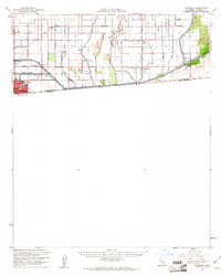
Editions of this 1957 Calexico Map
2 editions found
Other maps of this area

1907 · Holtville
USGS Topo · 1:125,000

1915 · El Centro
USGS Topo · 1:125,000

1940 · Brawley
USGS Topo · 1:62,500

1940 · Heber
USGS Topo · 1:62,500

1940 · Alamorio
USGS Topo · 1:62,500

1940 · Calexico
USGS Topo · 1:62,500

1942 · El Centro
USGS Topo · 1:250,000

1943 · Heber
USGS Topo · 1:62,500

1943 · Brawley
USGS Topo · 1:62,500

1943 · Calexico
USGS Topo · 1:62,500