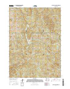
2017 Map of Calf Ranch Mountain
USGS Topo · Published 2017About this map
Ocean View Cem sits near the western edge of this coastal range landscape, marking the transition from the low-lying drainages to the high interior ridges of Coos and Curry counties. The terrain is defined by a dense network of tributaries including Floras Creek and the N Fork Sixes River, which carve through a series of named summits such as Buzzard Butte and Calf Ranch Mtn. The 2017 survey reveals how modern access roads like Langlois Mountain Rd and Dement Creek Rd follow the natural contours of the land, navigating between peaks like Watches Butte and Little Edson Butte. One of the most distinct cultural landmarks is the White Elephant Bridge on Floras Creek Rd, while the southern reaches open into the high-elevation Calf Ranch Prairie.
Find a feature on this map
42 named features on this map. Tap any name to fly to it.
Don’t see what you’re looking for? This feature index may not catch every label — zoom into the map to look around manually.
Map Details
Editions of this 2017 Calf Ranch Mountain Map
This is the sole edition of this map. No revisions or reprints were ever made.
Other maps of this area

1896 · Coos Bay
USGS Topo · 1:125,000

1898 · Coos Bay
USGS Topo · 1:125,000

1899 · Port Orford
USGS Topo · 1:125,000

1900 · Coos Bay
USGS Topo · 1:125,000

1903 · Port Orford
USGS Topo · 1:125,000

1942 · Coquille
USGS Topo · 1:62,500

1943 · Bandon
USGS Topo · 1:62,500

1944 · Bandon
USGS Topo · 1:62,500

1945 · Coquille
USGS Topo · 1:62,500

1954 · Coos Bay
USGS Topo · 1:250,000