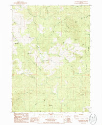
1985 Map of Calf Ranch Mtn
USGS Topo · Published 1986About this map
Calf Ranch Mtn dominates this southern Oregon interior as it appeared in the mid-1980s, a landscape defined by the complex headwaters of Floras Creek and its many branches. The terrain is marked by significant topographical landmarks such as Buzzard Butte, Cotton Butte, and Edson Butte, while man-made features like the Bennett Butte Radio Facility and the White Elephant Bridge provide specific points of reference for local historians. This era shows the region as a network of drainages and high prairies, including Bills Prairie and Calf Ranch Prairie. Seasonal or remote outposts like Camp Fir Croft and Doe Camp are documented alongside geographical features such as Oberg Canyon and Buzzard Butte Canyon. The map records the intersection of industrial and natural land use, evidenced by a Borrow Pit and the precise boundary line between Coos Co and Curry Co.
Find a feature on this map
39 named features on this map. Tap any name to fly to it.
Don’t see what you’re looking for? This feature index may not catch every label — zoom into the map to look around manually.
Map Details
Editions of this 1985 Calf Ranch Mtn Map
This is the sole edition of this map. No revisions or reprints were ever made.
Other maps of this area

1896 · Coos Bay
USGS Topo · 1:125,000

1898 · Coos Bay
USGS Topo · 1:125,000

1899 · Port Orford
USGS Topo · 1:125,000

1900 · Coos Bay
USGS Topo · 1:125,000

1903 · Port Orford
USGS Topo · 1:125,000

1942 · Coquille
USGS Topo · 1:62,500

1943 · Bandon
USGS Topo · 1:62,500

1944 · Bandon
USGS Topo · 1:62,500

1945 · Coquille
USGS Topo · 1:62,500

1954 · Coos Bay
USGS Topo · 1:250,000