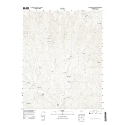
2013 Map of Caliente Canyon South
USGS Topo · Published 2013About this map
The Vermejo River carves through this northern New Mexico landscape, a territory defined by an intricate network of drainages and named canyons. Ranching activity is anchored at W S Ranch Camp and Horse Ranch Camp, reflecting the localized agricultural infrastructure of Colfax County. The terrain is marked by significant topographical features such as Caliente Canyon and Ben Thompson Canyon, while more descriptively named landmarks like Deadhorse Canyon and Hells Canyon suggest the challenging nature of the local geography. Access into these canyons is facilitated by unpaved routes including Bracket Rd and Spellman Rd. This detail provides a clear look at the drainage patterns of tributaries like Five Dollar Cr as they feed into the larger river system, offering insight into the water-dependent settlement patterns of this high-elevation region.
Find a feature on this map
25 named features on this map. Tap any name to fly to it.
Don’t see what you’re looking for? This feature index may not catch every label — zoom into the map to look around manually.
Map Details
Editions of this 2013 Caliente Canyon South Map
This is the sole edition of this map. No revisions or reprints were ever made.
Other maps of this area

1915 · Brilliant
USGS Topo · 1:62,500

1915 · Koehler
USGS Topo · 1:62,500

1917 · Koehler
USGS Topo · 1:62,500

1954 · Raton
USGS Topo · 1:250,000

1955 · Cimarron
USGS Topo · 1:62,500

1958 · Raton
USGS Topo · 1:250,000

1962 · Casa Grande
USGS Topo · 1:62,500

1971 · Saltpeter Mountain
USGS Topo · 1:24,000
1971 · Curtis Camp
USGS Topo · 1:24,000
1971 · Mc Williams Canyon
USGS Topo · 1:24,000