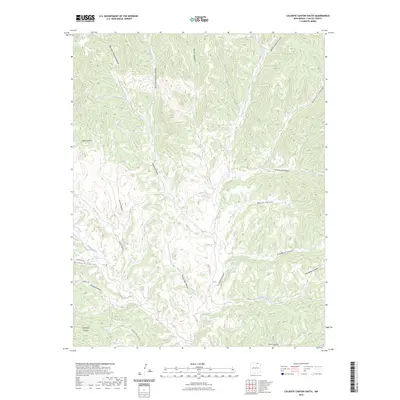
2023 Map of Caliente Canyon South
USGS Topo · Published 2023About this map
Vermejo River and Five-Dollar Creek provide the primary drainage for this complex network of canyons in Colfax County. The landscape is defined by its deep, namesake drainage at Caliente Canyon, which is fed by numerous smaller topographical features including Deadhorse Canyon and Five Dollar Canyon.
Find a feature on this map
24 named features on this map. Tap any name to fly to it.
Don’t see what you’re looking for? This feature index may not catch every label — zoom into the map to look around manually.
Map Details
Editions of this 2023 Caliente Canyon South Map
This is the sole edition of this map. No revisions or reprints were ever made.
Other maps of this area

1915 · Brilliant
USGS Topo · 1:62,500

1915 · Koehler
USGS Topo · 1:62,500

1917 · Koehler
USGS Topo · 1:62,500

1954 · Raton
USGS Topo · 1:250,000

1955 · Cimarron
USGS Topo · 1:62,500

1958 · Raton
USGS Topo · 1:250,000

1962 · Casa Grande
USGS Topo · 1:62,500

1971 · Saltpeter Mountain
USGS Topo · 1:24,000
1971 · Curtis Camp
USGS Topo · 1:24,000
1971 · Mc Williams Canyon
USGS Topo · 1:24,000