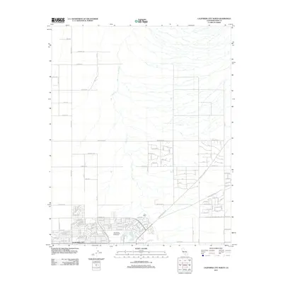
2012 Map of California City North
USGS Topo · Published 2012About this map
California City displays a unique mid-century master-planned layout in this high-desert landscape, characterized by an extensive grid of platted roads that stretch far beyond the core developed areas. The southern portion of the map shows the realized community center, including the Tierra del Sol Championship Golf Course and Central Park Lake, which provide a sharp contrast to the surrounding arid terrain. Moving northward, the grid becomes increasingly theoretical, with long thoroughfares like Neuralia Rd and 90th St cutting through the desert towards Anne Ave. The drainage of Cache Cr meanders across these planned blocks, following the natural topography while the historical route of the Randsburg Mojave Rd angles southeast across the residential street grid. This map documents the ambitious scale of desert urban planning during the early 21st century, illustrating where established neighborhoods meet speculative infrastructure.
Find a feature on this map
81 named features on this map. Tap any name to fly to it.
Don’t see what you’re looking for? This feature index may not catch every label — zoom into the map to look around manually.
Map Details
Editions of this 2012 California City North Map
This is the sole edition of this map. No revisions or reprints were ever made.
Other maps of this area

1915 · Searles Lake
USGS Topo · 1:250,000

1915 · Mojave
USGS Topo · 1:125,000

1943 · Cross Mountain
USGS Topo · 1:62,500

1943 · Saltdale
USGS Topo · 1:62,500

1943 · Castle Butte
USGS Topo · 1:62,500

1943 · Mojave
USGS Topo · 1:62,500

1947 · Castle Butte
USGS Topo · 1:50,000

1947 · Plano
USGS Topo · 1:24,000

1947 · Desert Butte
USGS Topo · 1:24,000
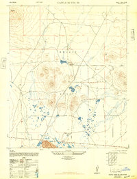
1947 · Castle Butte SE
USGS Topo · 1:24,000