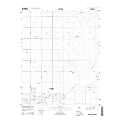
2015 Map of California City North
USGS Topo · Published 2015About this map
California City serves as the central hub of this desert landscape, exhibiting a complex grid of planned roads that stretch across the Mojave Desert. The map reveals the interplay between residential development and the natural environment of the Fremont Valley, with significant thoroughfares like California City Blvd and Lindbergh Blvd anchoring the local community. To the north, the terrain transitions into the Rand Mountains, while the interior of the settlement is punctuated by Central Park Lake. The ephemeral drainage of Cache Cr meanders through the central sections, illustrating the typical hydrology of this arid region. This topographic survey captures the extent of local infrastructure, including extensive named residential streets and the rural land divisions defined by the Public Land Survey System, such as t31s r37e.
Find a feature on this map
75 named features on this map. Tap any name to fly to it.
Don’t see what you’re looking for? This feature index may not catch every label — zoom into the map to look around manually.
Map Details
Editions of this 2015 California City North Map
This is the sole edition of this map. No revisions or reprints were ever made.
Other maps of this area

1915 · Searles Lake
USGS Topo · 1:250,000

1915 · Mojave
USGS Topo · 1:125,000

1943 · Cross Mountain
USGS Topo · 1:62,500

1943 · Saltdale
USGS Topo · 1:62,500

1943 · Castle Butte
USGS Topo · 1:62,500

1943 · Mojave
USGS Topo · 1:62,500

1947 · Castle Butte
USGS Topo · 1:50,000

1947 · Plano
USGS Topo · 1:24,000

1947 · Desert Butte
USGS Topo · 1:24,000
1947 · Castle Butte SE
USGS Topo · 1:24,000