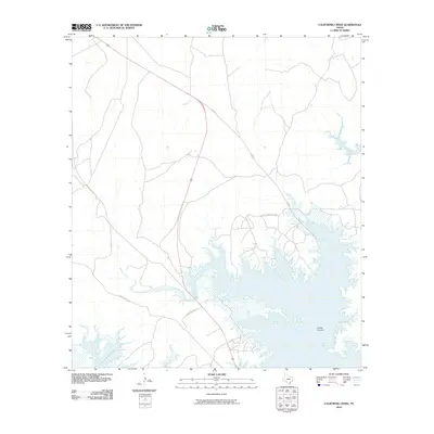
2010 Map of California Creek
USGS Topo · Published 2010About this map
Amistad Reservoir dominates the southern landscape of this Val Verde County region, where the rising waters of the Rio Grande basin have transformed the deep drainages of the desert. The rugged topography is defined by the carved limestone of Castle Canyon, a prominent terrain feature that lends its name to the nearby residential development of Castle Canyon Estate. This area illustrates the late 20th-century shift toward recreational and lakeside living in west Texas, with local infrastructure such as Box Canyon Dr and SS 408 N providing access to the water's edge. To the north, the ephemeral paths of California Creek and Evans Creek cut through the arid plains, eventually meeting the reservoir. The presence of U.S. Route 90 serves as the primary corridor for travelers moving across this portion of the Texas borderlands.
Find a feature on this map
8 named features on this map. Tap any name to fly to it.
Don’t see what you’re looking for? This feature index may not catch every label — zoom into the map to look around manually.
Map Details
Editions of this 2010 California Creek Map
This is the sole edition of this map. No revisions or reprints were ever made.
Other maps of this area

1941 · Feely
USGS Topo · 1:62,500

1943 · Devils River
USGS Topo · 1:62,500

1943 · Del Rio
USGS Topo · 1:62,500

1944 · Devils River
USGS Topo · 1:62,500

1944 · Devils Lake
USGS Topo · 1:62,500

1958 · Del Rio
USGS Topo · 1:250,000

1964 · Del Rio
USGS Topo · 1:250,000

1972 · Amistad Dam
USGS Topo · 1:24,000

1972 · California Creek
USGS Topo · 1:24,000
1972 · Del Rio NW
USGS Topo · 1:24,000