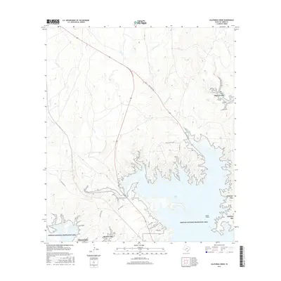
2016 Map of California Creek
USGS Topo · Published 2016About this map
Amistad National Recreation Area dominates the southern portion of this landscape, where the rising waters of the reservoir create a complex, branched shoreline. The geography is defined by deep incisions in the limestone plateau, most notably at Big Canyon and Castle Canyon. This network of canyons and plateaus dictates the modern settlement pattern, seen in the development of Castle Canyon Estate along the higher ground.
Find a feature on this map
19 named features on this map. Tap any name to fly to it.
Don’t see what you’re looking for? This feature index may not catch every label — zoom into the map to look around manually.
Map Details
Editions of this 2016 California Creek Map
This is the sole edition of this map. No revisions or reprints were ever made.
Other maps of this area

1941 · Feely
USGS Topo · 1:62,500

1943 · Devils River
USGS Topo · 1:62,500

1943 · Del Rio
USGS Topo · 1:62,500

1944 · Devils River
USGS Topo · 1:62,500

1944 · Devils Lake
USGS Topo · 1:62,500

1958 · Del Rio
USGS Topo · 1:250,000

1964 · Del Rio
USGS Topo · 1:250,000

1972 · Amistad Dam
USGS Topo · 1:24,000

1972 · California Creek
USGS Topo · 1:24,000
1972 · Del Rio NW
USGS Topo · 1:24,000