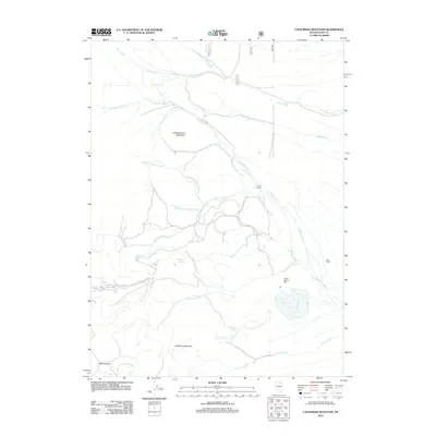
2012 Map of California Mountain
USGS Topo · Published 2012About this map
Jerritt Canyon Mill stands as a significant industrial landmark in this high-altitude landscape of Elko County, marking a site of modern mineral processing. The terrain is defined by the prominent peaks of California Mountain and Independence Mountain, which together shape a complex drainage network including the waters of Foreman Creek and Pratt Creek. Evidence of ranching and livestock history is preserved through labels for Evans Ranch and Jose Ranch, both situated along the drainages that flow from the steep canyons. Water remains the lifeblood of this arid mountain range, noted by various high-country sources such as Arthenice Spring, Deadmans Spring, and Mahoney Spring. A network of Forest Service roads, including routes 1500c and 892a, provides the primary access through the drainages of Winters Creek and California Creek, illustrating the remote but managed nature of these Nevada highlands.
Find a feature on this map
22 named features on this map. Tap any name to fly to it.
Don’t see what you’re looking for? This feature index may not catch every label — zoom into the map to look around manually.
Map Details
Editions of this 2012 California Mountain Map
This is the sole edition of this map. No revisions or reprints were ever made.
Other maps of this area

1955 · McDermitt
USGS Topo · 1:250,000

1955 · Wells
USGS Topo · 1:250,000

1956 · Tuscarora
USGS Topo · 1:62,500

1956 · Bull Run
USGS Topo · 1:62,500

1956 · Wild Horse
USGS Topo · 1:62,500

1958 · Wells
USGS Topo · 1:250,000

1959 · McDermitt
USGS Topo · 1:250,000

1961 · Wells
USGS Topo · 1:250,000

1971 · Mahala Creek West
USGS Topo · 1:24,000

1971 · North Fork
USGS Topo · 1:24,000