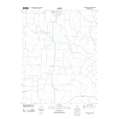
2011 Map of California South
USGS Topo · Published 2011About this map
The sprawling drainage of North Moreau Creek and its many tributaries, including Burris Fork and Mineral Branch, define the rural landscape south of the city of California. This central Missouri region is characterized by a network of county roads and family-named landmarks that trace the area's agricultural and social history. Notable for genealogists are several rural burial grounds scattered across the terrain, such as Boeckhaus Cemetery in the north and Yarnold Cemetery further south. The map also highlights smaller named communities like Brant and Corticelli, along with topographic features such as Gobblers Knob. The presence of Railroad Lake and references to older infrastructure like Harmony School Rd and the Burris Fork Bridge reflect the local economy and community development patterns of Moniteau County in the early 21st century.
Find a feature on this map
77 named features on this map. Tap any name to fly to it.
Don’t see what you’re looking for? This feature index may not catch every label — zoom into the map to look around manually.
Map Details
Editions of this 2011 California South Map
This is the sole edition of this map. No revisions or reprints were ever made.
Other maps of this area

1886 · Jefferson City
USGS Topo · 1:125,000

1888 · Versailles
USGS Topo · 1:125,000

1888 · Tuscumbia
USGS Topo · 1:125,000

1888 · Boonville
USGS Topo · 1:125,000

1893 · Versailles
USGS Topo · 1:125,000

1894 · Tuscumbia
USGS Topo · 1:125,000

1894 · Jefferson City
USGS Topo · 1:125,000

1904 · Eldon
USGS Topo · 1:62,500

1947 · Jefferson City
USGS Topo · 1:250,000

1948 · Centertown
USGS Topo · 1:62,500