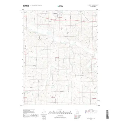
2017 Map of California South
USGS Topo · Published 2017About this map
Corticelli and the southern edge of California anchor this 2017 study of the Missouri interior, where the landscape is defined by the winding course of North Moreau Creek and its many tributaries. The area is dense with sites for genealogical research, including the Boeckhaus Cem, Burris Fork Cem, and Gamble Cem. This modern survey documents a rural infrastructure of named crossings like the Burris Fork Bridge and McDowell Bridge, alongside small water bodies such as Railroad Lake and Derbey Lake. The map reveals a complex network of county and state routes, including State Hwy F and State Hwy MM, which connect scattered homesteads and agricultural tracts. Natural features such as Clifty Spring Spr and the drainage of Burris Fork illustrate the hydrology of Moniteau County before recent development, preserving the locations of family-named landmarks like Yarnold Cem and Defore Cem.
Find a feature on this map
91 named features on this map. Tap any name to fly to it.
Don’t see what you’re looking for? This feature index may not catch every label — zoom into the map to look around manually.
Map Details
Editions of this 2017 California South Map
This is the sole edition of this map. No revisions or reprints were ever made.
Other maps of this area

1886 · Jefferson City
USGS Topo · 1:125,000

1888 · Versailles
USGS Topo · 1:125,000

1888 · Tuscumbia
USGS Topo · 1:125,000

1888 · Boonville
USGS Topo · 1:125,000

1893 · Versailles
USGS Topo · 1:125,000

1894 · Tuscumbia
USGS Topo · 1:125,000

1894 · Jefferson City
USGS Topo · 1:125,000

1904 · Eldon
USGS Topo · 1:62,500

1947 · Jefferson City
USGS Topo · 1:250,000

1948 · Centertown
USGS Topo · 1:62,500