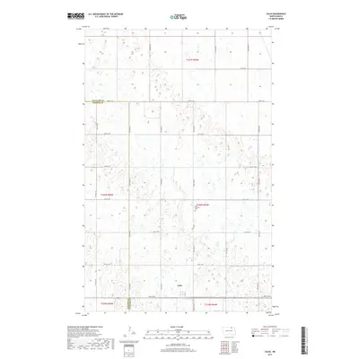
2017 Map of Calio
USGS Topo · Published 2017About this map
Calio sits at the heart of this prairie landscape, serving as a primary point of interest in a region defined by its precise section-line road grid and scattered wetlands. The map reveals the intricate network of glacial potholes and small water bodies that characterize this portion of the northern plains, where agriculture and hydrology dictate the layout of the land. Evidence of the area's social history is anchored by Saint Boniface Cem located along Co Rd 3, providing a specific touchstone for genealogists and local historians. This 2017 survey details the border between Cavalier and Towner counties, illustrating how modern infrastructure like 84th St NE and 77th Ave NE continues to follow the historic township and range system established over a century ago.
Find a feature on this map
25 named features on this map. Tap any name to fly to it.
Don’t see what you’re looking for? This feature index may not catch every label — zoom into the map to look around manually.
Map Details
Editions of this 2017 Calio Map
This is the sole edition of this map. No revisions or reprints were ever made.
Other maps of this area

1953 · Devils Lake
USGS Topo · 1:250,000

1956 · Devils Lake
USGS Topo · 1:250,000

1962 · Egeland SE
USGS Topo · 1:24,000

1962 · Egeland
USGS Topo · 1:24,000

1970 · Calvin
USGS Topo · 1:24,000

1970 · Sarles SE
USGS Topo · 1:24,000

1970 · Rock Lake SE
USGS Topo · 1:24,000

1970 · Munich
USGS Topo · 1:24,000

1971 · Calio
USGS Topo · 1:24,000

1971 · Munich SW
USGS Topo · 1:24,000