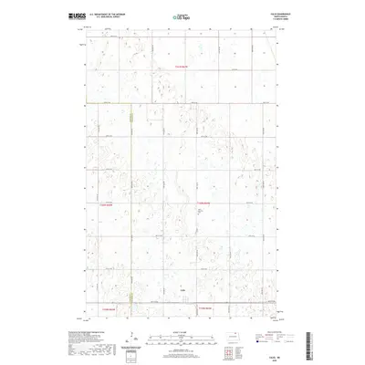
2020 Map of Calio
USGS Topo · Published 2020About this map
Calio serves as the central focal point of this rural prairie landscape, located on the boundary between Towner Co and Cavalier Co. The settlement is surrounded by a vast grid of section lines and gravel roads, including Co Rd 3 and numerous township routes such as 84th St NE. This layout reflects the enduring influence of the Public Land Survey System on the North Dakota plains, where human development is etched into a mosaic of wetlands and small kettle lakes. A short distance north of the primary settlement, Saint Boniface Cem provides a tangible link to the local heritage of this agricultural region. The map captures the quiet transition between rural townships, illustrating the sparse but deliberate distribution of homesteads and infrastructure across the county line.
Find a feature on this map
24 named features on this map. Tap any name to fly to it.
Don’t see what you’re looking for? This feature index may not catch every label — zoom into the map to look around manually.
Map Details
Editions of this 2020 Calio Map
This is the sole edition of this map. No revisions or reprints were ever made.
Other maps of this area

1953 · Devils Lake
USGS Topo · 1:250,000

1956 · Devils Lake
USGS Topo · 1:250,000

1962 · Egeland SE
USGS Topo · 1:24,000

1962 · Egeland
USGS Topo · 1:24,000

1970 · Calvin
USGS Topo · 1:24,000

1970 · Sarles SE
USGS Topo · 1:24,000

1970 · Rock Lake SE
USGS Topo · 1:24,000

1970 · Munich
USGS Topo · 1:24,000

1971 · Calio
USGS Topo · 1:24,000

1971 · Munich SW
USGS Topo · 1:24,000