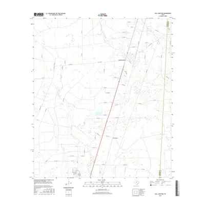
2016 Map of Call Junction
USGS Topo · Published 2016About this map
Call Junction and the nearby settlement of Le Verte anchor this East Texas landscape along the Jasper and Newton County border. The terrain is defined by an intricate network of waterways, including the winding course of Cypress Creek to the west and Nichols Creek to the east. These drainages, alongside smaller tributaries like Big Branch and Deer Creek, create a complex hydrological pattern that has historically shaped local land use and transportation.
Find a feature on this map
74 named features on this map. Tap any name to fly to it.
Don’t see what you’re looking for? This feature index may not catch every label — zoom into the map to look around manually.
Map Details
Editions of this 2016 Call Junction Map
This is the sole edition of this map. No revisions or reprints were ever made.
Other maps of this area

1952 · Lake Charles
USGS Topo · 1:250,000

1954 · Lake Charles
USGS Topo · 1:250,000

1954 · Beaumont
USGS Topo · 1:250,000

1955 · Silsbee
USGS Topo · 1:62,500

1955 · Bessmay
USGS Topo · 1:62,500

1957 · Beaumont
USGS Topo · 1:250,000

1958 · Spurger
USGS Topo · 1:62,500

1958 · Kirbyville
USGS Topo · 1:62,500

1984 · Beaumont
USGS Topo · 1:250,000

1984 · Potato Patch Lake
USGS Topo · 1:24,000