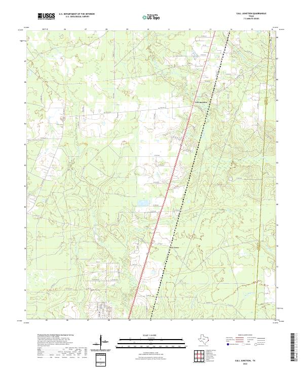
2022 Map of Call Junction
USGS Topo · Published 2022About this map
Call Junction serves as the central hub of this East Texas landscape, where the primary north-south roadway bisects a region defined by an intricate network of drainage and creek beds. The terrain is dominated by the winding paths of Cypress Cr and Red Bank Cr, which weave through the timber-rich boundary area between Jasper Co and Newton Co. The settlement of Le Verte sits further south, connected by a web of rural routes like Co RD 613 that link the scattered homesteads and ranches to the main artery.
Find a feature on this map
70 named features on this map. Tap any name to fly to it.
Don’t see what you’re looking for? This feature index may not catch every label — zoom into the map to look around manually.
Map Details
Editions of this 2022 Call Junction Map
This is the sole edition of this map. No revisions or reprints were ever made.
Other maps of this area

1952 · Lake Charles
USGS Topo · 1:250,000

1954 · Lake Charles
USGS Topo · 1:250,000

1954 · Beaumont
USGS Topo · 1:250,000

1955 · Silsbee
USGS Topo · 1:62,500

1955 · Bessmay
USGS Topo · 1:62,500

1957 · Beaumont
USGS Topo · 1:250,000

1958 · Spurger
USGS Topo · 1:62,500

1958 · Kirbyville
USGS Topo · 1:62,500

1984 · Beaumont
USGS Topo · 1:250,000

1984 · Potato Patch Lake
USGS Topo · 1:24,000