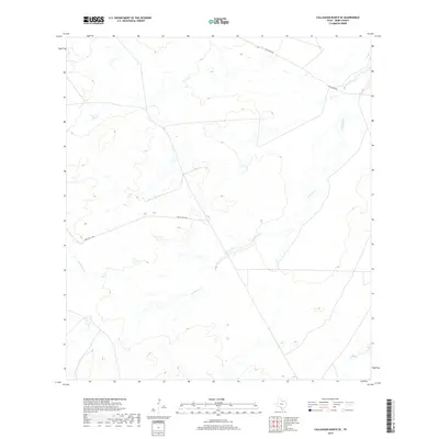
2019 Map of Callaghan Ranch SE
USGS Topo · Published 2019About this map
Carrizitos Cr winds through the heart of this Webb County ranching landscape, serving as a primary drainage feature for the surrounding terrain. The map documents the sparse but structured infrastructure of the region during the late 2010s, defined by the orientation of Callaghan Rd and Ranch Rd 6178A. This 2019 survey by the U.S. Geological Survey provides a precise view of the dry creek beds and access roads that characterize the cattle country of South Texas. The absence of densely clustered settlements emphasizes the massive scale of the private landholdings in this area, where the topography and watercourses like Carrizitos Cr remain the most significant landmarks for navigation and land management.
Find a feature on this map
3 named features on this map. Tap any name to fly to it.
Don’t see what you’re looking for? This feature index may not catch every label — zoom into the map to look around manually.
Map Details
Editions of this 2019 Callaghan Ranch SE Map
This is the sole edition of this map. No revisions or reprints were ever made.
Other maps of this area

1937 · Aguilete Creek
USGS Topo · 1:62,500

1956 · Becerra
USGS Topo · 1:62,500

1956 · Laredo East
USGS Topo · 1:62,500

1956 · Webb
USGS Topo · 1:62,500

1956 · Laredo
USGS Topo · 1:250,000

1965 · Orvil
USGS Topo · 1:24,000

1965 · Cibolo Ranch
USGS Topo · 1:24,000
1980 · Callaghan Ranch SE
USGS Topo · 1:24,000
1980 · Venado Creek West
USGS Topo · 1:24,000
1980 · Piedra Parada Tank
USGS Topo · 1:24,000